 English (EUR) | EN
For many of us, it’s easy to forget that trails don’t just appear on the landscape and it’s surprising to find out that it takes years to plan and coordinate to build a successful trail with many different stakeholders involved as well. What it means to complete the trail, and the behind the scenes work that goes into doing so, isn’t always clear. In fact, it’s the goal of a trail designer/builder and the sign of a well thought out trail, if users don’t think much about how the two-foot wide trail came to be. The CDTC strives to build a fully connected, fully on-trail (not roads) path, but how do we move the route from a road to a trail? And what goes into building a trail?
That’s what Dan Carter, CDTC’s Trail and Lands Conservation Specialist, is here to do.
As Dan explains it, completing the trail means fulfilling the vision and subsequent plans laid out for the Continental Divide National Scenic Trail (CDT) back in 1978. This vision entails having a continuous, protected scenic trail along the Continental Divide corridor. Dan’s role in this involves research, planning, design, and coordination with agencies and stakeholders to find routes that will take the CDT off roads and onto protected trails. Sounds simple enough but it takes lots of time, talking with people and scouting around terrain near the Divide.
Dan has been working with Big Agnes to complete a section of trail at Muddy Pass – the last gap in the CDT through Colorado. Currently, at Muddy Pass the CDT follows roads open to motorized traffic (Forest and County roads and State highways). In addition to adopting 75 miles of trail, including Muddy Pass, near their headquarters in Steamboat Springs, CO, Big Agnes has been in the field with Dan and has committed time and resources to rerouting the trail.

In 2018, Big Agnes adopted 75 miles of the Continental Divide Trail as part of our support of the Continental Divide Trail Coalition. As an adopter we agreed to do our part to maintain the designated portion of trail, mark the trail as needed, keep it free of trash, and be good stewards of the trail whenever we found ourselves recreating on it. Which turns out, with its proximity to our office, is quite often. To celebrate our adoption, we decided to hike the entire Colorado section of the trail over the course of the summer in 2018. Yup. 740 miles! Three months, 70 employees, 146,000 vertical feet up and down. Topping out at 14,000 feet on Grays Peak summit. Unfortunately there is still a section on our adopted portion that takes you out of the wilderness and onto the road – a busy highway to be exact.
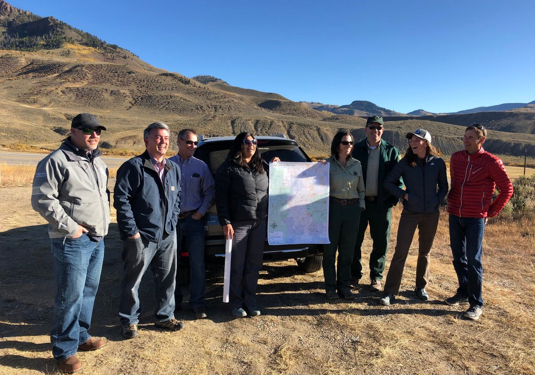
After reviewing a couple conceptual reroute alignments with stakeholders, including US Senator Cory Gardner, field scouting began this summer. Dan identified some good existing trails and potential routes for the CDT during a scouting trip. Now, the working group (made up of CDTC, USFS, BLM, and State agency representatives) will continue to work with local landowners and stakeholders to refine the alignment, secure access, and begin planning.
Like at Muddy Pass, each section of the trail that needs to be built or rerouted, Dan tells us there needs to be a vision and/or a demonstrated need. In the case of CDTC’s work, the vision was laid out when the CDT was established and the demonstrated need is to reroute the sections where the CDT follows roads, dirt forest roads to major highways, which are dangerous and do not meet National Scenic Trail standards. From identifying the sections, the process involves looking over lots of maps and GIS data and talking with local land management agencies, trail users, stakeholders, and landowners about possible trail alignments, ideas, and concerns. All that information gets boiled down into a potential route. Then, Dan gets on the ground to see what it looks like and to identify any unforeseen barriers or features that would add or detract to the CDT experience. Dan brings all that information back to the group of stakeholders and they refine the alignment based on the field scouting.

Scouting alignments also involve speaking with landowners and public land permittee’s to address concerns and discuss access across land they own or use for other purposes such as grazing. The local knowledge these people have is critical to getting the lay of the land and connecting with those that know it best. This planning phase is an iterative process in which Dan takes into consideration many ideas and tries to design a route that will work the best for everyone involved from thru-hikers to ranchers. Once the alignment is decided and legal access is secured, the trail alignment is flagged on the ground. Finally, trail crews (USFS trail crews, non-profit conservation corps, or volunteer projects led by CDTC) will construct the trail. Along the way, securing financial resources is critical so staff, trail crews, and materials can be funded.
Completing the trail is important for many reasons. As Dan puts it, “A National Scenic Trail is a national treasure. Trails of this length and quality are found nowhere else. So, to complete the CDT as originally envisioned, a continuous, protected corridor from Mexico to Canada, is fulfilling a grand idea that protects, connects, and showcases so many aspects of the people and landscapes of the Continental Divide and the American West. From a day hike to a long journey spanning months, locals to the international traveler, the CDT has something for everyone.”
As a supporter of the CDT, you can demonstrate your commitment to the trail by making the Pledge to Protect, sharing it with friends and family, joining one of our volunteer trail work days or Trail Adopter trainings, and checking out other ways to support the CDT.


